Sala de mapasMap room
Cartografía de épocaPeriod cartography
Hojas militares y planos urbanos contemporáneos de su servicio, con su fecha de catálogo, escala y procedencia. Se muestran aquí como documentos; el mapa del relato y del atlas no los superpone.
Military sheets and city plans from the years of his service, each with its catalogue date, scale and provenance. They are shown here as documents; the story and atlas maps do not overlay them.
Hojas militares, 1912–1922Military sheets, 1912–1922
7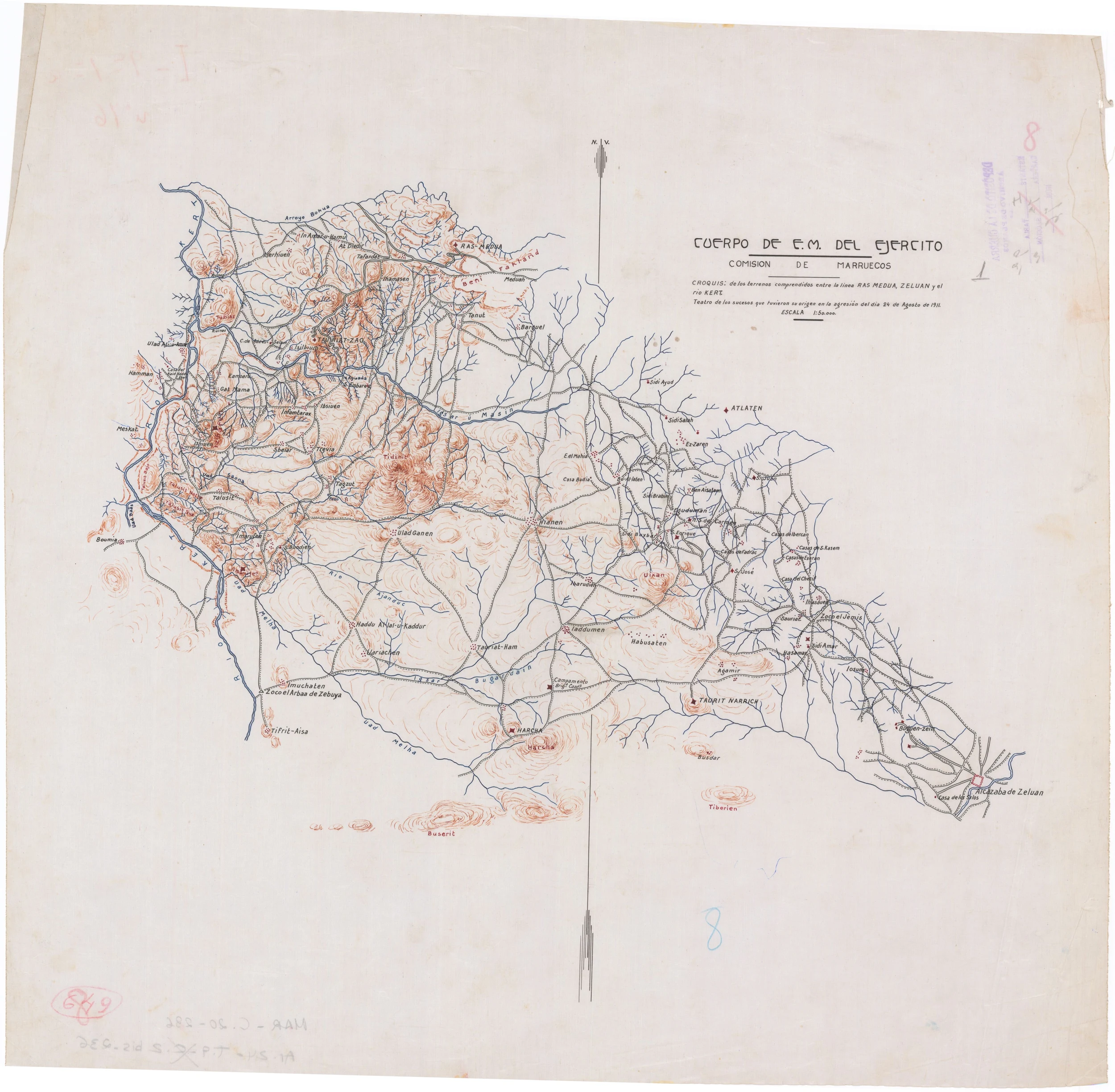 Abrir la imagen completa: Croquis de los terrenos comprendidos entre la línea Ras Medua, Zeluan y el río Kert.Open the full image: Sketch of the ground between the Ras Medua–Zeluan line and the Kert river.
Croquis de los terrenos comprendidos entre la línea Ras Medua, Zeluan y el río Kert.Sketch of the ground between the Ras Medua–Zeluan line and the Kert river.
Fuente: Archivo Cartográfico de Estudios Geográficos del Centro Geográfico del Ejército / Biblioteca Virtual de Defensa.Source: Cartographic and Geographic Studies Archive of the Army Geographic Centre / Biblioteca Virtual de Defensa. · CC BY 4.0
Ficha del catálogoCatalogue record ↗Imagen completaFull image
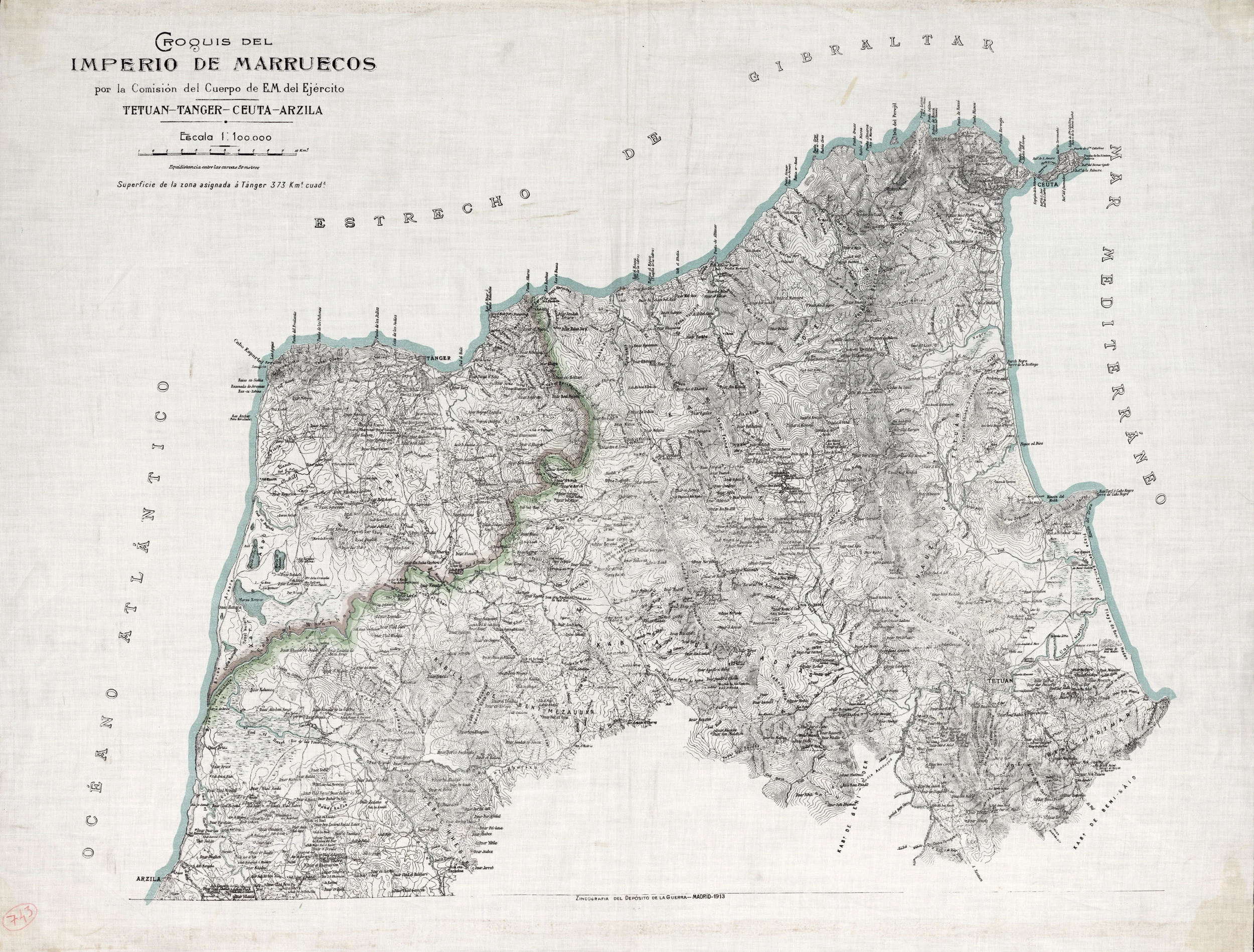 Abrir la imagen completa: Croquis del Imperio de Marruecos: Tetuán–Tánger–Ceuta–Arzila.Open the full image: Sketch of the Moroccan Empire: Tétouan–Tangier–Ceuta–Asilah.
Croquis del Imperio de Marruecos: Tetuán–Tánger–Ceuta–Arzila.Sketch of the Moroccan Empire: Tétouan–Tangier–Ceuta–Asilah.
Fuente: Archivo Cartográfico de Estudios Geográficos del Centro Geográfico del Ejército / Biblioteca Virtual de Defensa.Source: Cartographic and Geographic Studies Archive of the Army Geographic Centre / Biblioteca Virtual de Defensa. · CC BY 4.0
Ficha del catálogoCatalogue record ↗Imagen completaFull image
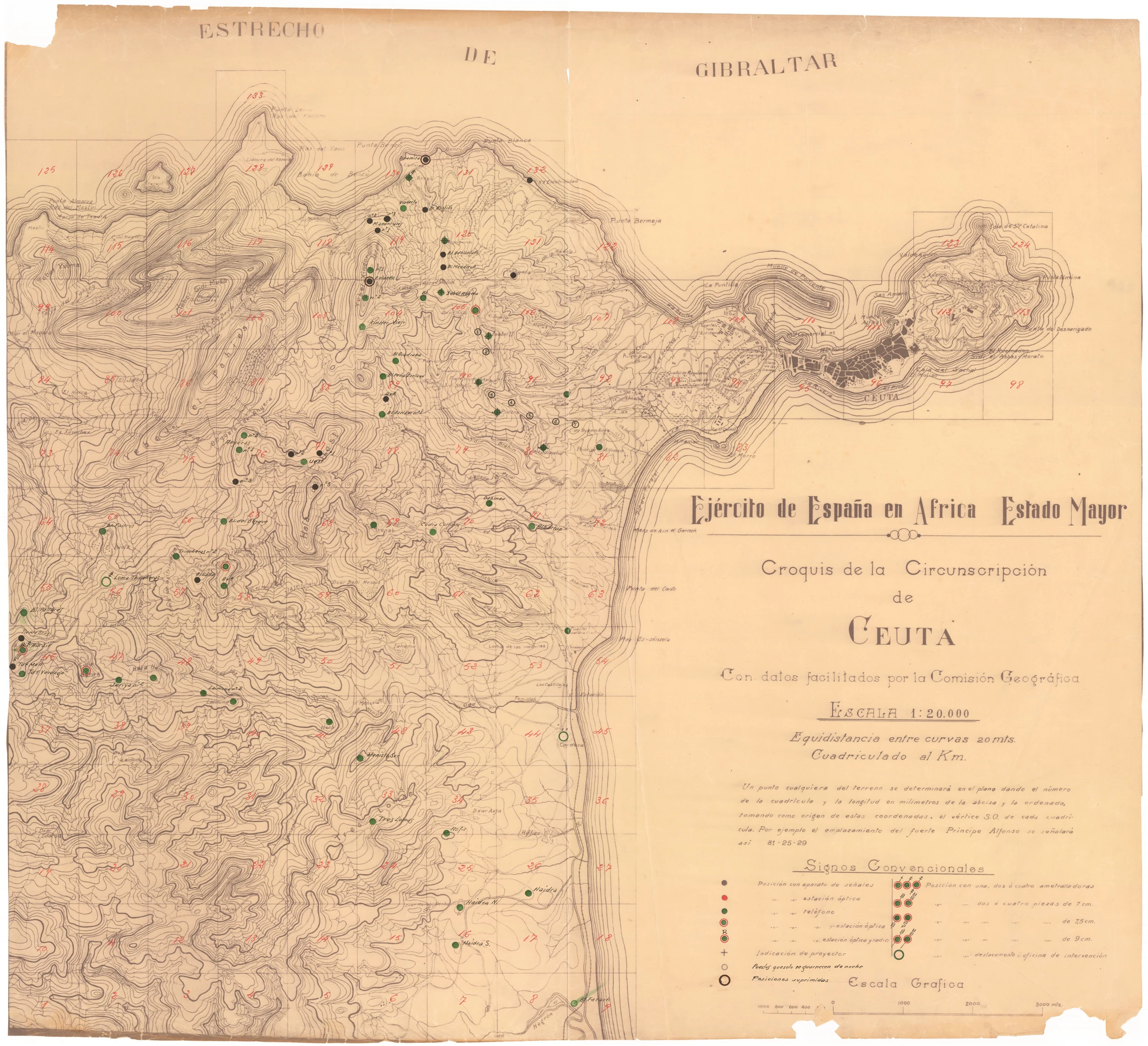 Abrir la imagen completa: Croquis de la Circunscripción de Ceuta.Open the full image: Sketch of the Ceuta Circumscription.
Croquis de la Circunscripción de Ceuta.Sketch of the Ceuta Circumscription.
Fuente: Archivo Cartográfico de Estudios Geográficos del Centro Geográfico del Ejército / Biblioteca Virtual de Defensa.Source: Cartographic and Geographic Studies Archive of the Army Geographic Centre / Biblioteca Virtual de Defensa. · CC BY 4.0
Ficha del catálogoCatalogue record ↗Imagen completaFull image
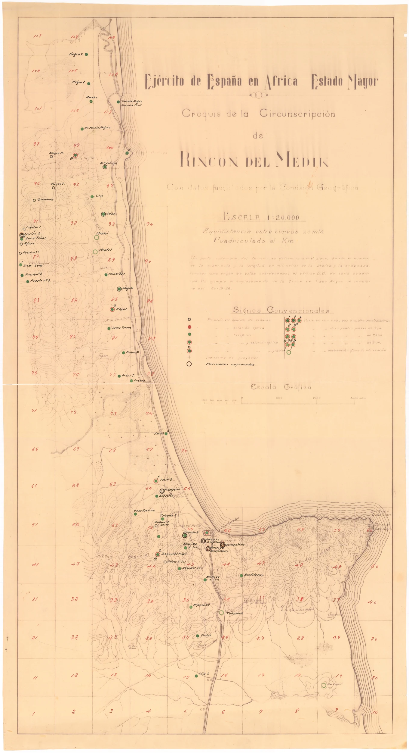 Abrir la imagen completa: Croquis de la Circunscripción de Rincón del Medik.Open the full image: Sketch of the Rincón del Medik Circumscription.
Croquis de la Circunscripción de Rincón del Medik.Sketch of the Rincón del Medik Circumscription.
Fuente: Archivo Cartográfico de Estudios Geográficos del Centro Geográfico del Ejército / Biblioteca Virtual de Defensa.Source: Cartographic and Geographic Studies Archive of the Army Geographic Centre / Biblioteca Virtual de Defensa. · CC BY 4.0
Ficha del catálogoCatalogue record ↗Imagen completaFull image
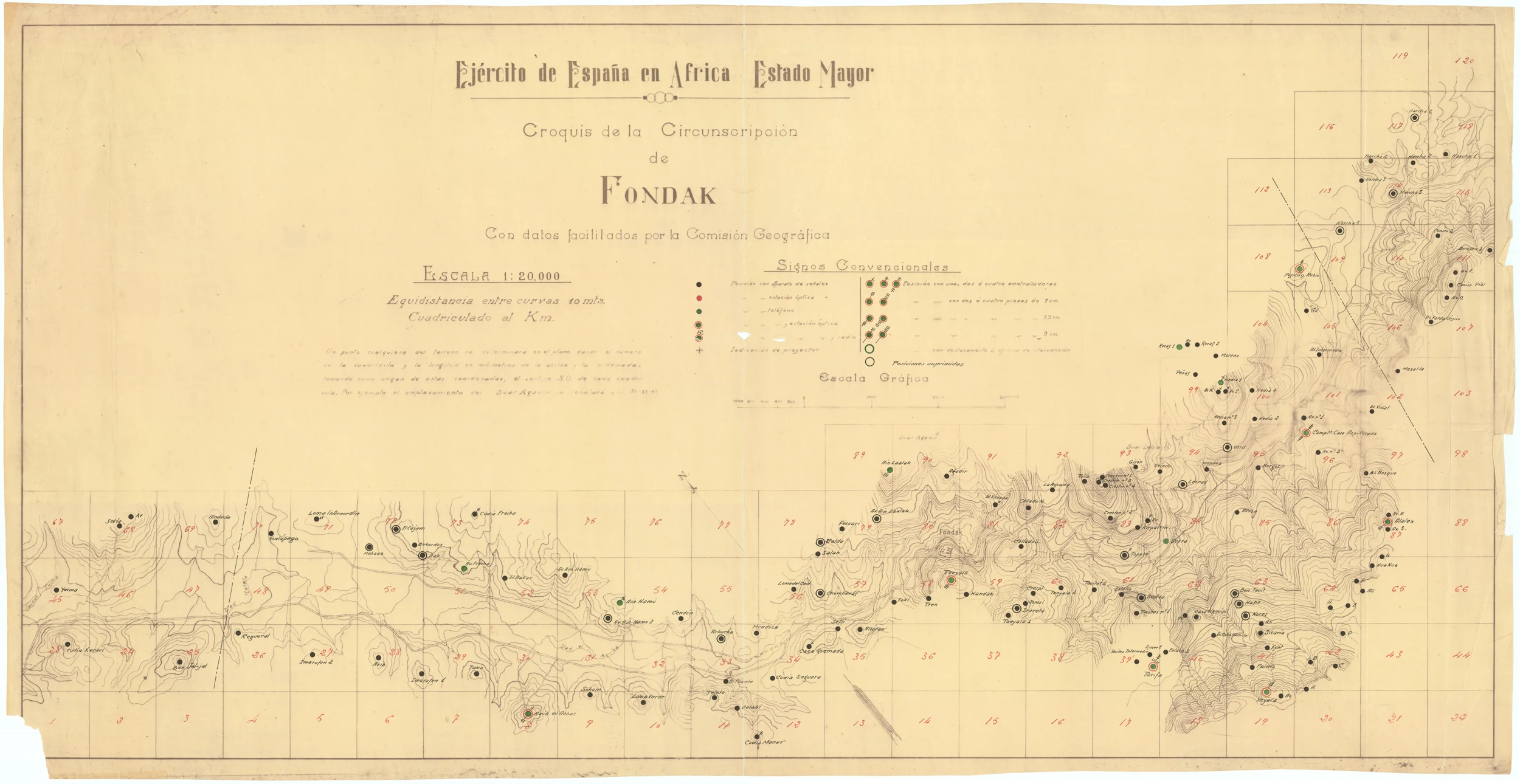 Abrir la imagen completa: Croquis de la Circunscripción de Fondak.Open the full image: Sketch of the Fondak Circumscription.
Croquis de la Circunscripción de Fondak.Sketch of the Fondak Circumscription.
Fuente: Archivo Cartográfico de Estudios Geográficos del Centro Geográfico del Ejército / Biblioteca Virtual de Defensa.Source: Cartographic and Geographic Studies Archive of the Army Geographic Centre / Biblioteca Virtual de Defensa. · CC BY 4.0
Ficha del catálogoCatalogue record ↗Imagen completaFull image
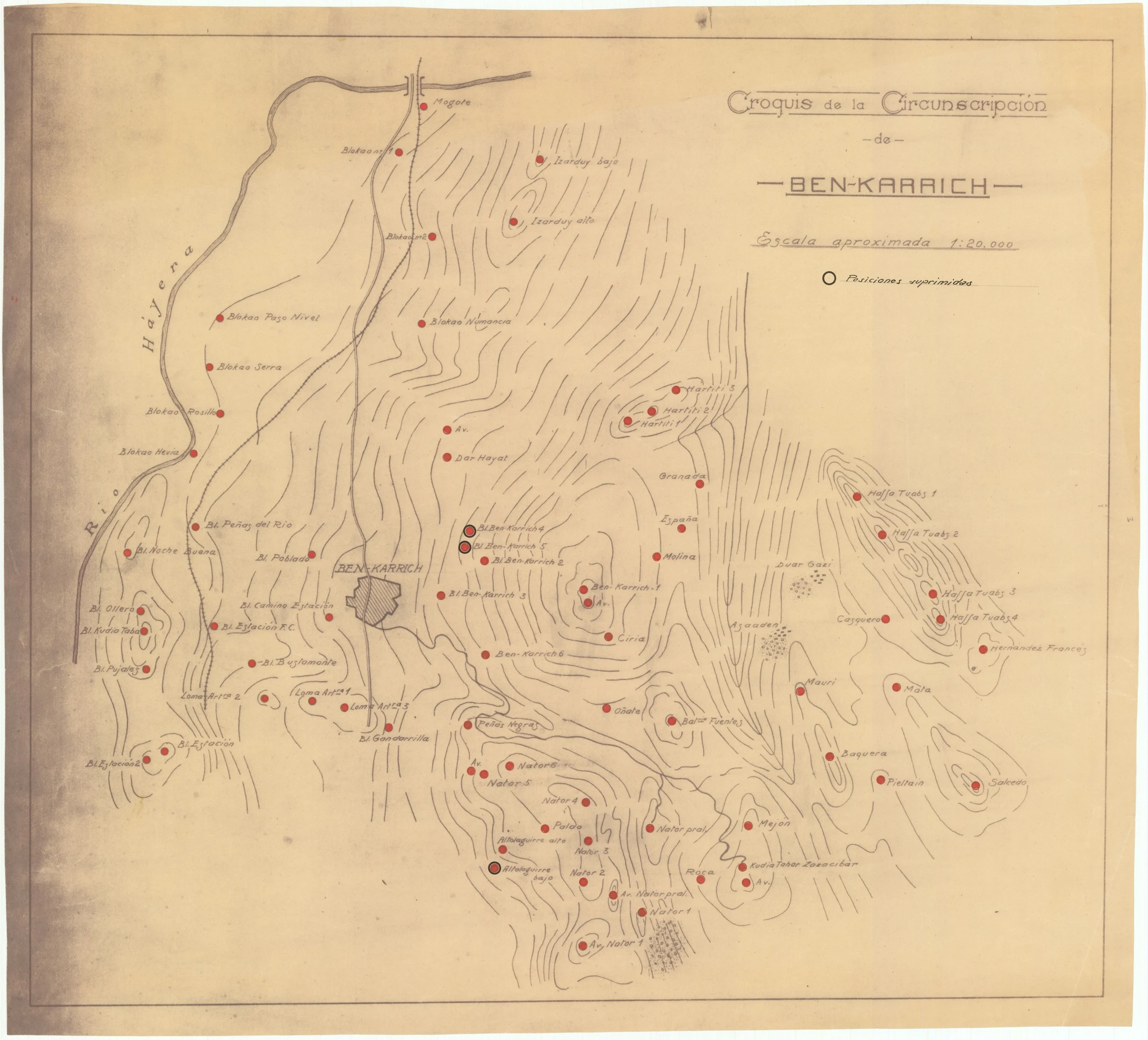 Abrir la imagen completa: Croquis de la Circunscripción de Ben-Karrich.Open the full image: Sketch of the Ben-Karrich Circumscription.
Croquis de la Circunscripción de Ben-Karrich.Sketch of the Ben-Karrich Circumscription.
Fuente: Archivo Cartográfico de Estudios Geográficos del Centro Geográfico del Ejército / Biblioteca Virtual de Defensa.Source: Cartographic and Geographic Studies Archive of the Army Geographic Centre / Biblioteca Virtual de Defensa. · CC BY 4.0
Ficha del catálogoCatalogue record ↗Imagen completaFull image
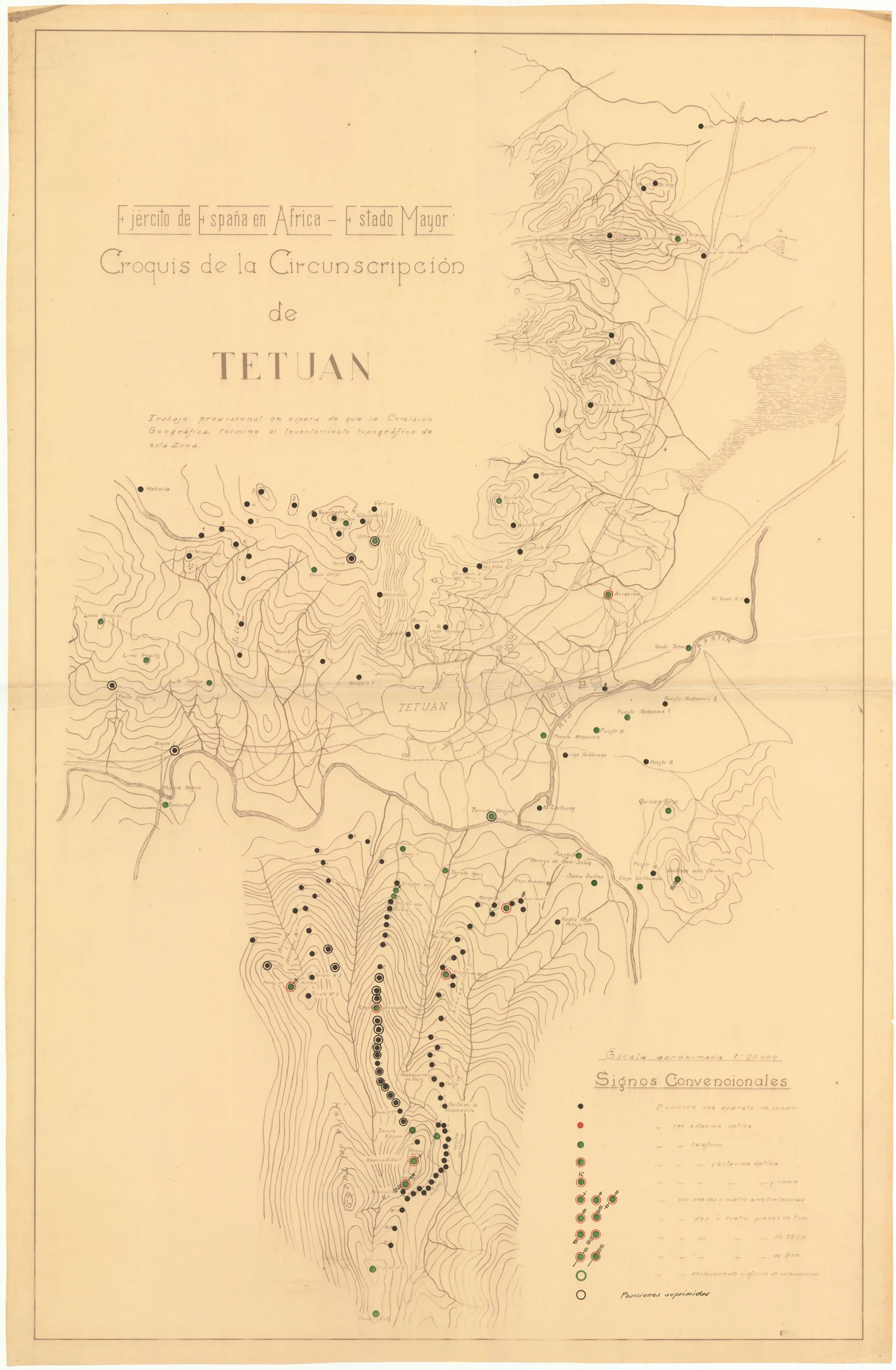 Abrir la imagen completa: Croquis de la Circunscripción de Tetuán.Open the full image: Sketch of the Tétouan Circumscription.
Croquis de la Circunscripción de Tetuán.Sketch of the Tétouan Circumscription.
Fuente: Archivo Cartográfico de Estudios Geográficos del Centro Geográfico del Ejército / Biblioteca Virtual de Defensa.Source: Cartographic and Geographic Studies Archive of the Army Geographic Centre / Biblioteca Virtual de Defensa. · CC BY 4.0
Ficha del catálogoCatalogue record ↗Imagen completaFull image
Planos de ciudadesCity plans
4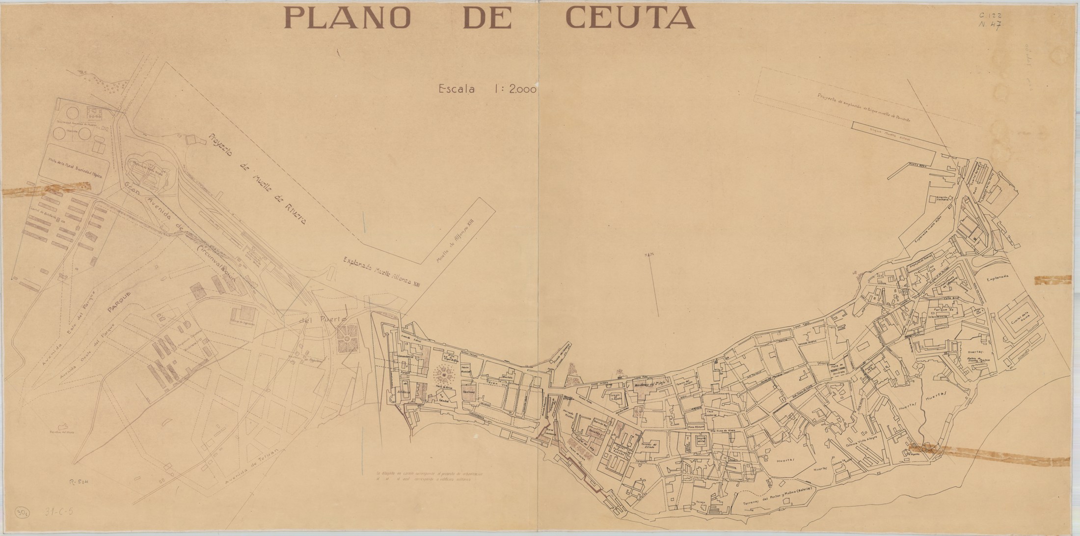 Abrir la imagen completa: Plano de Ceuta.Open the full image: Plan of Ceuta.
Plano de Ceuta.Plan of Ceuta.
Edificios y recintos existentesExisting buildings and compounds
Instituto Geográfico Nacional de España (IGN), Cartoteca, IGN016366 — CC BY 4.0.National Geographic Institute of Spain (IGN), Map Library, IGN016366 — CC BY 4.0. · CC BY 4.0
Ficha del catálogoCatalogue record ↗Imagen completaFull image
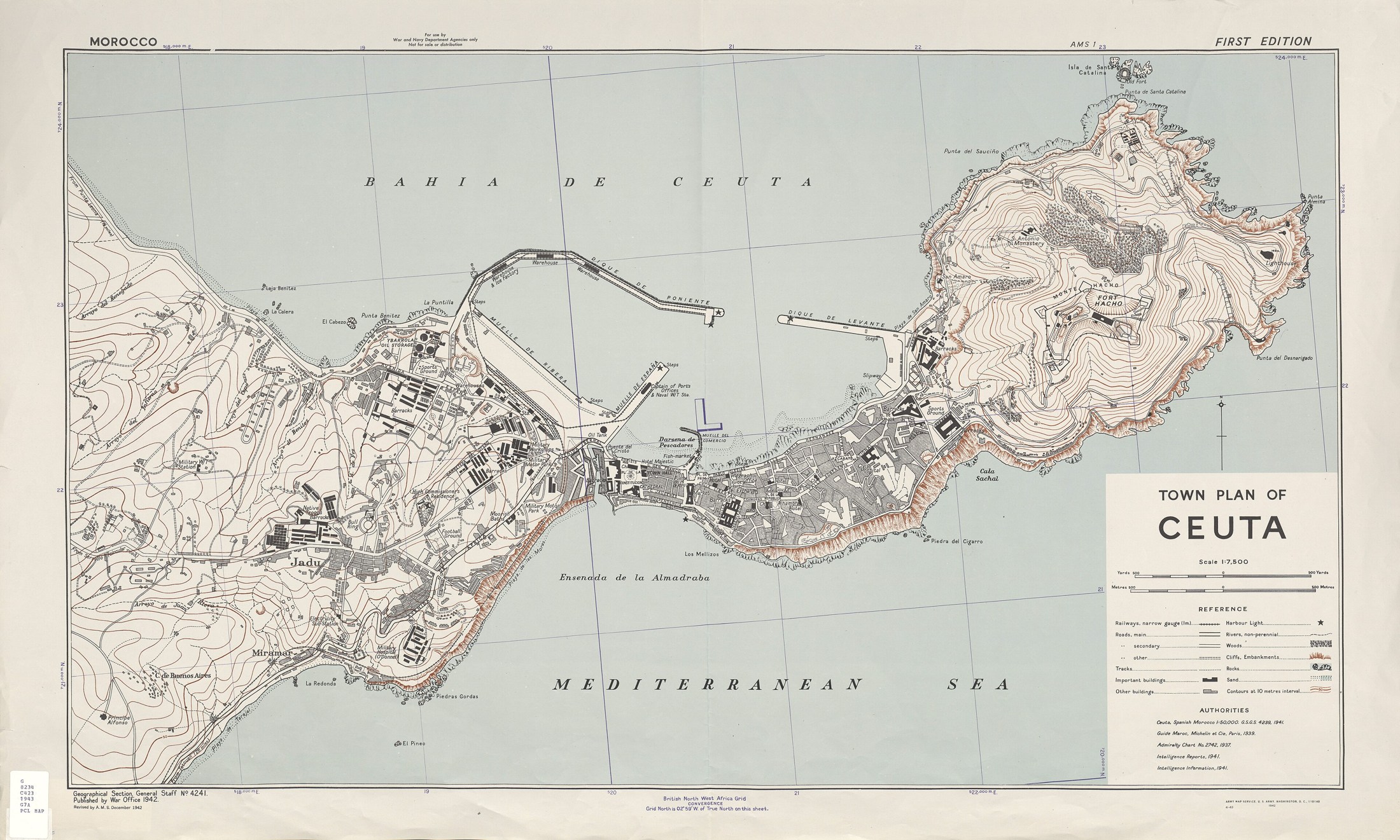 Abrir la imagen completa: Plano urbano de Ceuta.Open the full image: Town Plan of Ceuta.
Plano urbano de Ceuta.Town Plan of Ceuta.
Tejido urbano de la penínsulaPeninsula urban fabric
U.S. Army Map Service, vía Wikimedia Commons — dominio público en Estados Unidos.U.S. Army Map Service, via Wikimedia Commons — public domain in the United States. · Dominio público (gobierno federal de EE. UU.). / Public domain (U.S. federal government).
Ficha del catálogoCatalogue record ↗Imagen completaFull image
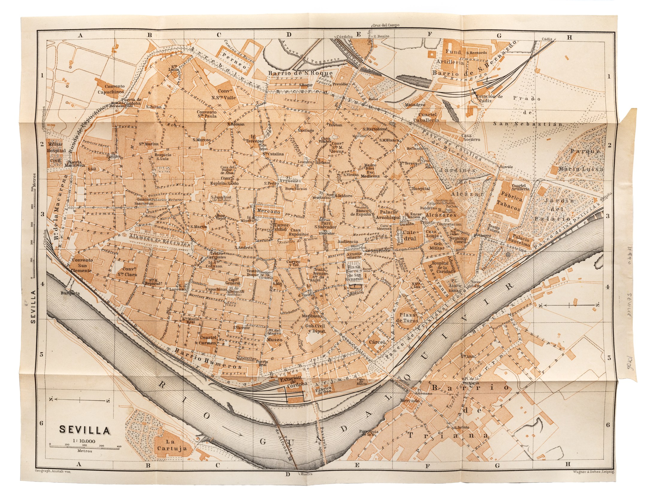 Abrir la imagen completa: Sevilla.Open the full image: Seville.
Sevilla.Seville.
Centro, Triana y barrios históricosCentre, Triana and historic districts
Colección Antonio González Cordón, AGC & Asociados, S.A.; Instituto de Estadística y Cartografía de Andalucía — CC BY 4.0.Antonio González Cordón Collection, AGC & Asociados, S.A.; Andalusian Institute of Statistics and Cartography — CC BY 4.0. · CC BY 4.0
Ficha del catálogoCatalogue record ↗Imagen completaFull image
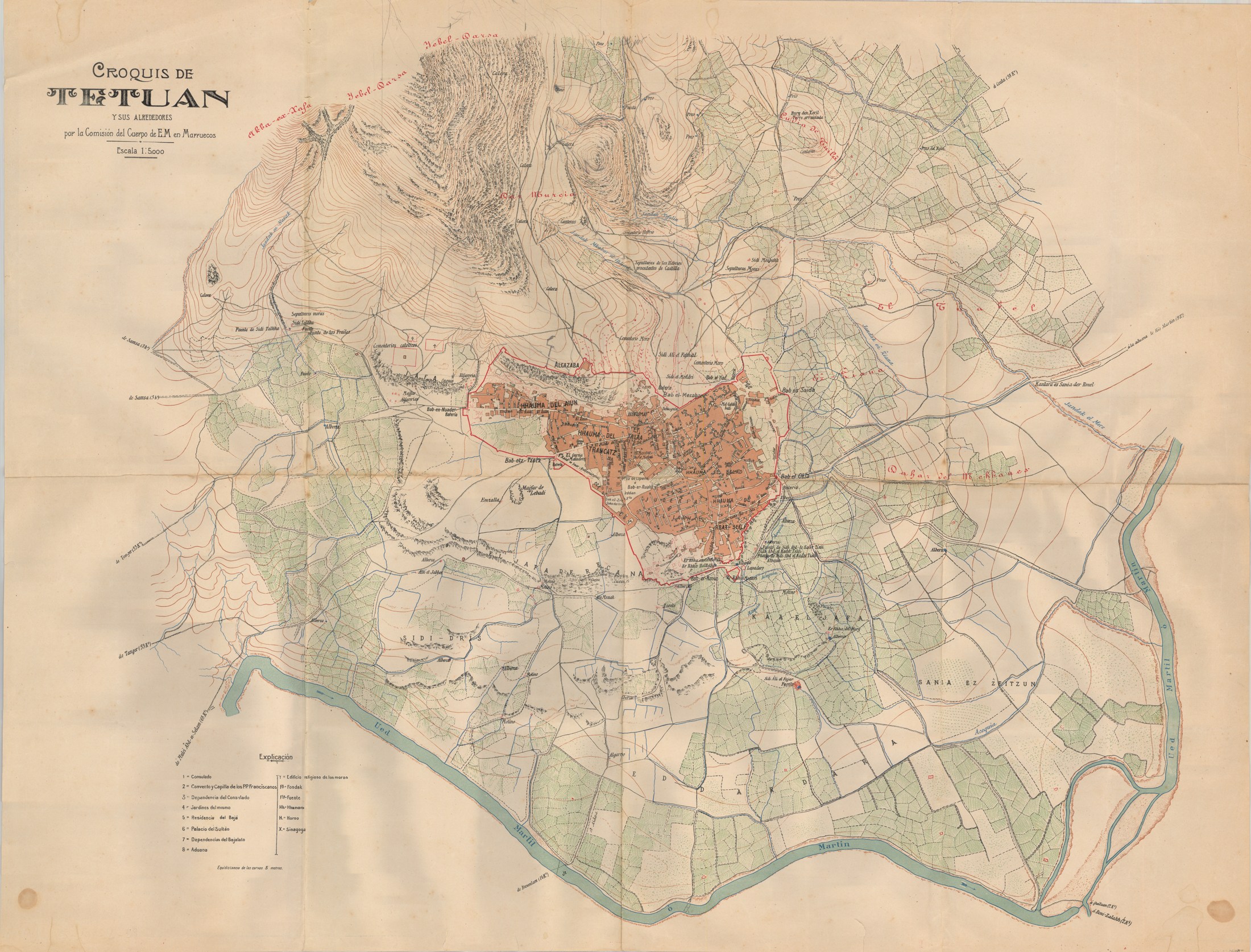 Abrir la imagen completa: Croquis de Tetuán y sus alrededores.Open the full image: Sketch of Tétouan and its surroundings.
Croquis de Tetuán y sus alrededores.Sketch of Tétouan and its surroundings.
Medina y edificios de la AlcazabaMedina and Alcazaba buildings
Instituto Geográfico Nacional de España (IGN), Cartoteca, IGN023836 — CC BY 4.0.National Geographic Institute of Spain (IGN), Map Library, IGN023836 — CC BY 4.0. · CC BY 4.0
Ficha del catálogoCatalogue record ↗Imagen completaFull image
De tres de estos planos se derivan los contornos del tejido urbano histórico que el atlas dibuja al acercarse a Ceuta, Sevilla y Tetuán. No son límites administrativos.
Three of these plans supply the historical built-fabric outlines the atlas draws when zoomed into Ceuta, Seville and Tétouan. They are not administrative limits.